Earth’s rivers are one of the largest sources of accessible fresh water. Due to climate change, river flows are changing and problems such as flooding and water scarcity are of particular concern. To better understand these environmental conditions and help plan for the future, scientist are observing, measuring and tracking varying amounts of water flowing through and discharged from rivers in space and time.
However, understanding how water flows across rivers systems is limited. Historically, rivers have primarily been studied by comparing models and observations at a given place over time. To further this research, NASA is developing satellites that will provide more detailed spatial and temporal data. But scientists do not have aggregate comparison tools to extrapolate river water behavior across observation points and time.
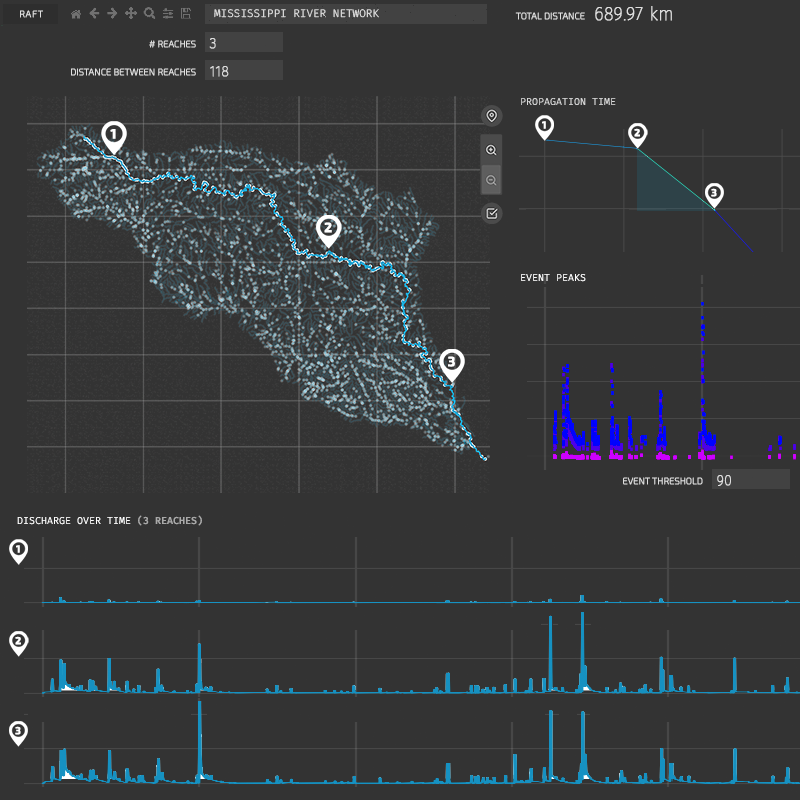
We created RAFT, a tool built to better understand and communicate how water propagates through space and time within river systems. RAFT visualizes distance and time of peaks in water discharge in the context of tree-like river maps that include tributaries, enabling researchers to track events as they propagate downstream. Our tool allows hydrologists to examine celerity, a measurement of how water events propagate across a river and vary over time and space.